Datasets of sewer networks with aerial and ground platforms


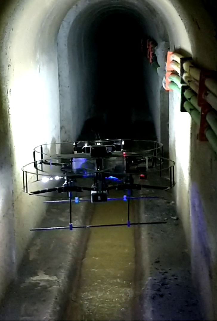
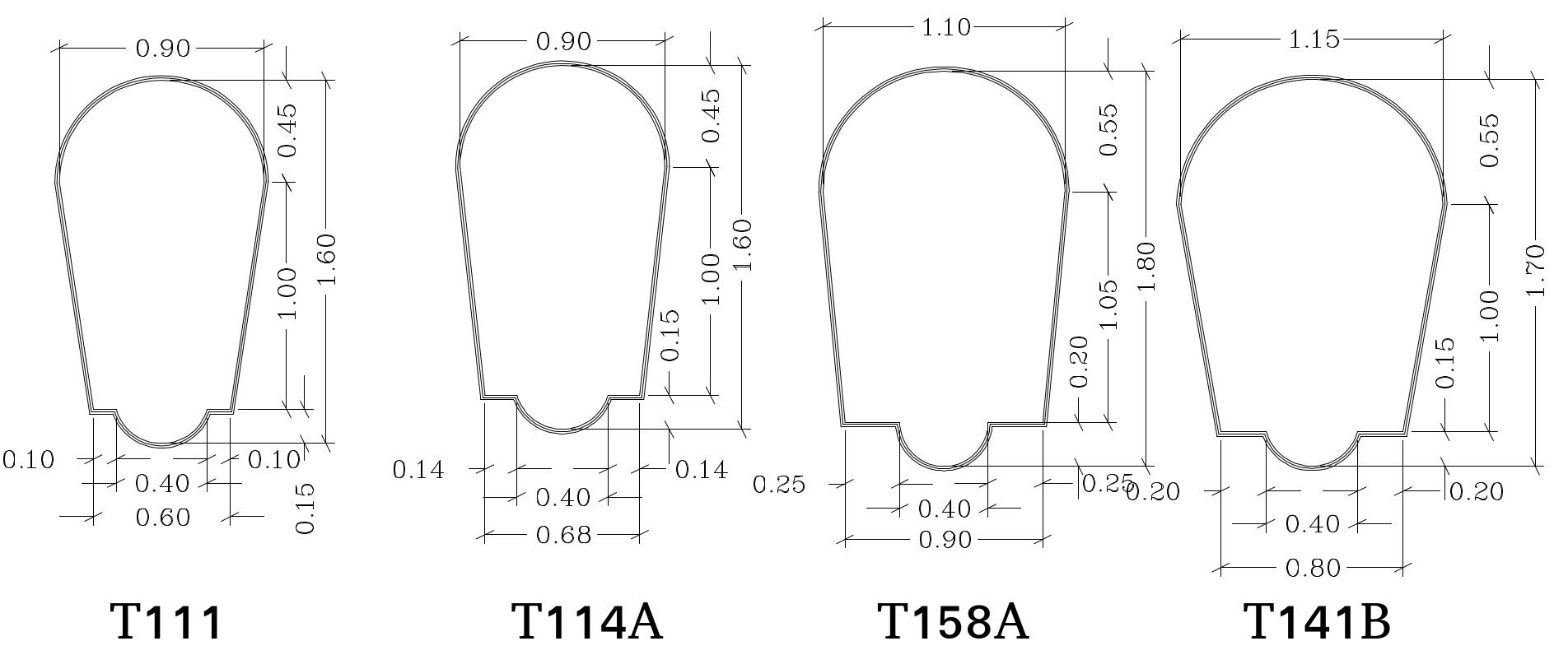
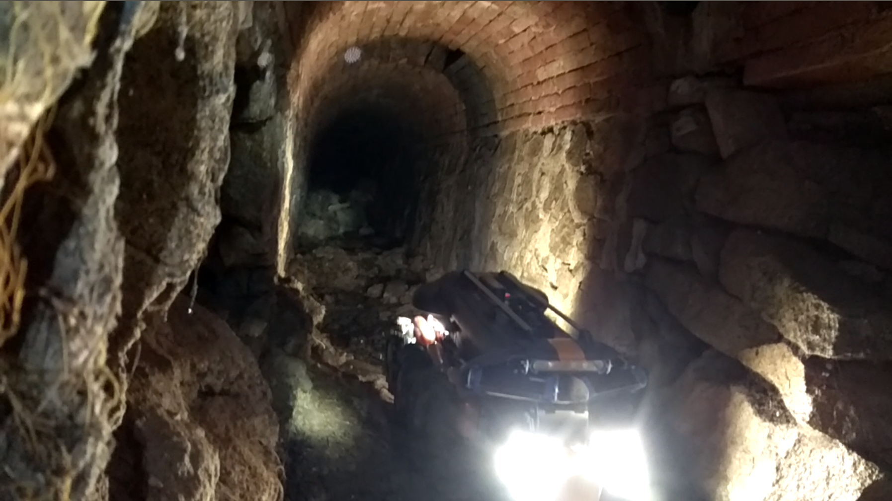
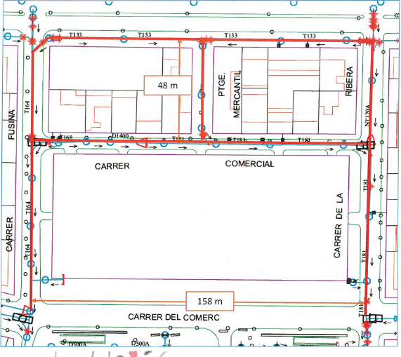
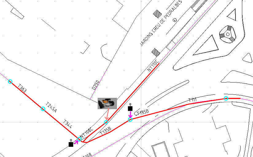
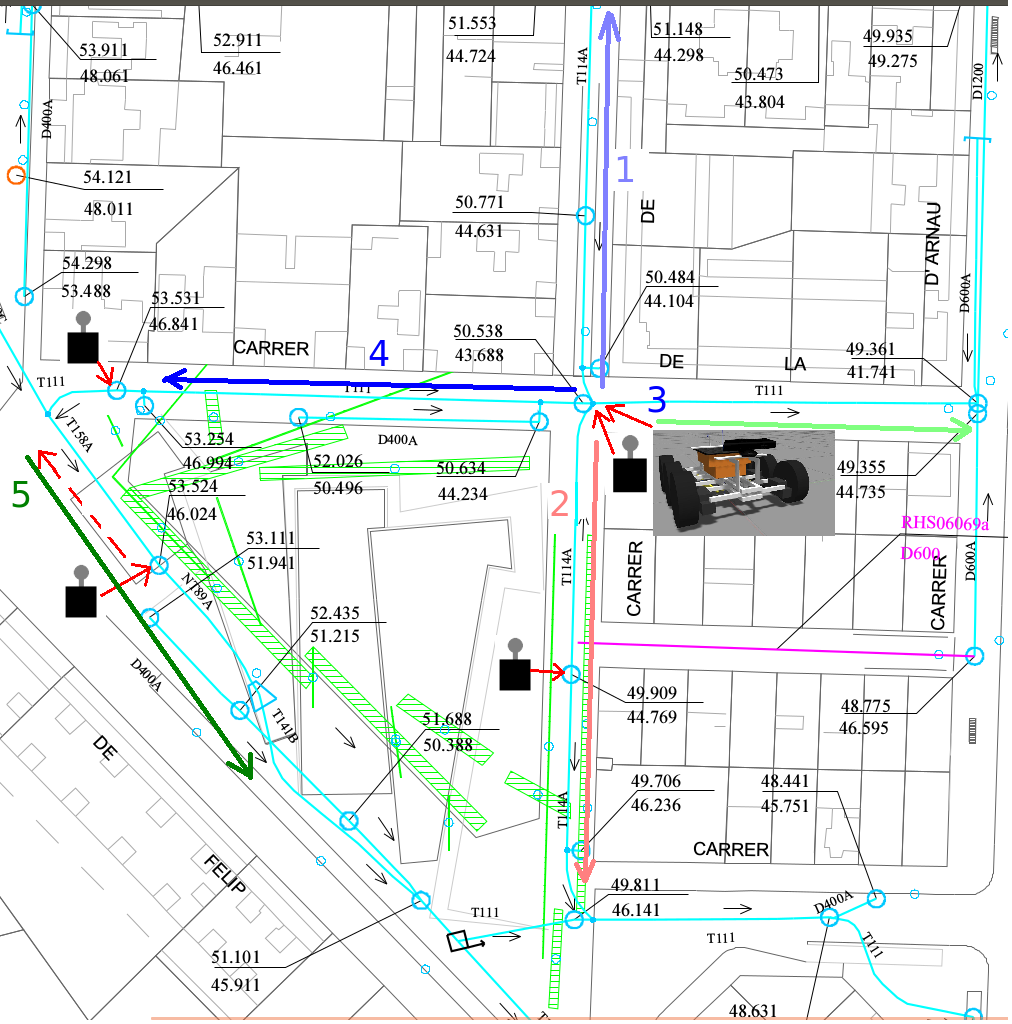
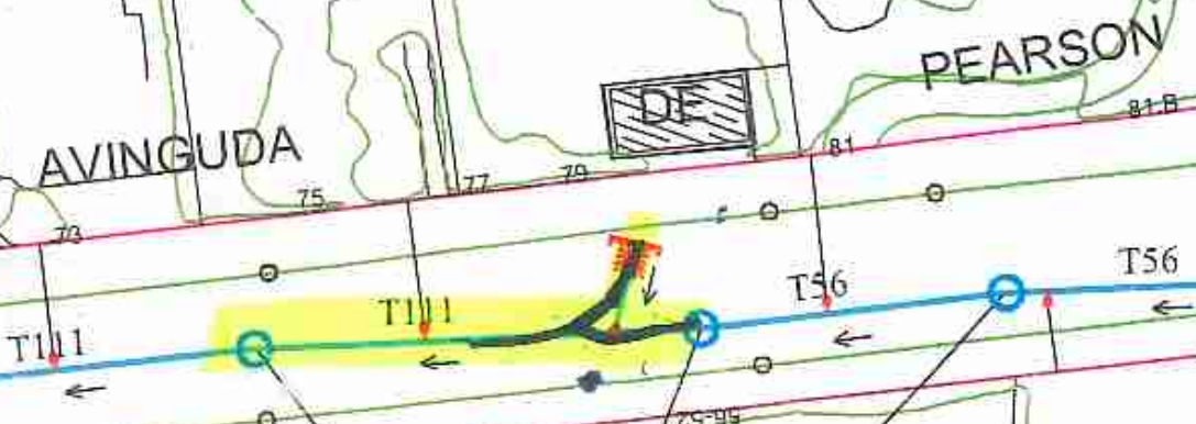
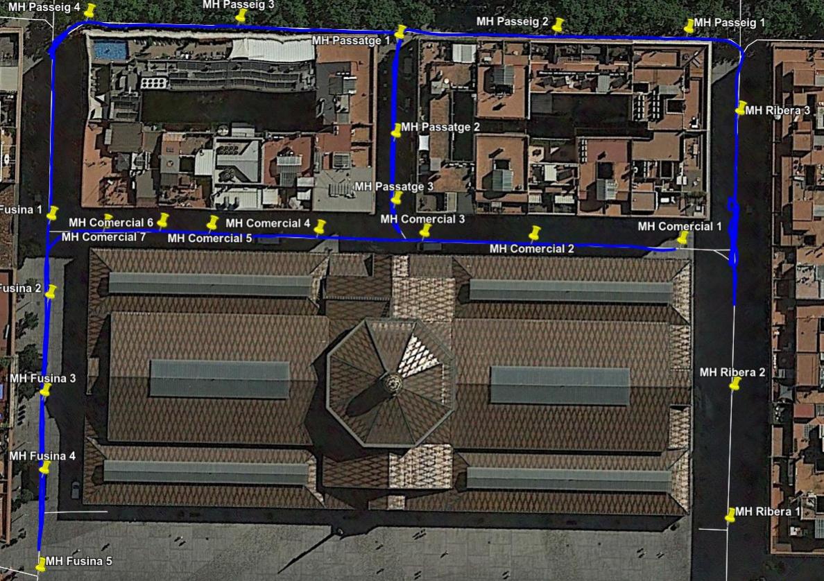
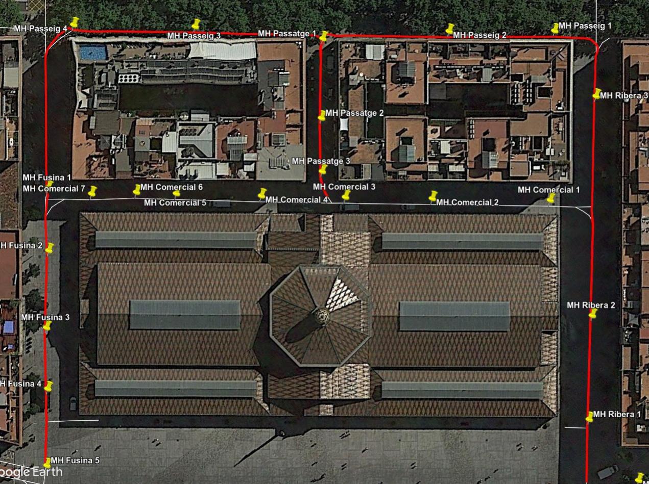
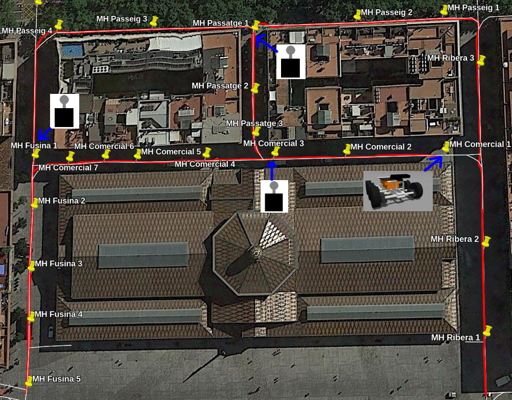
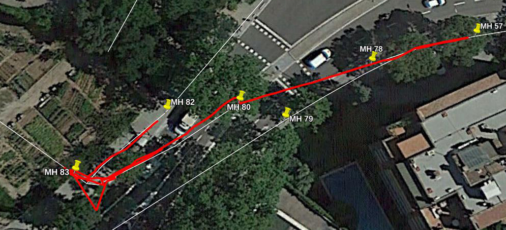
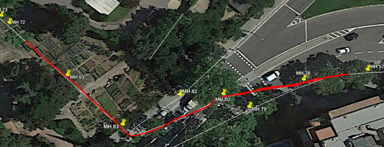
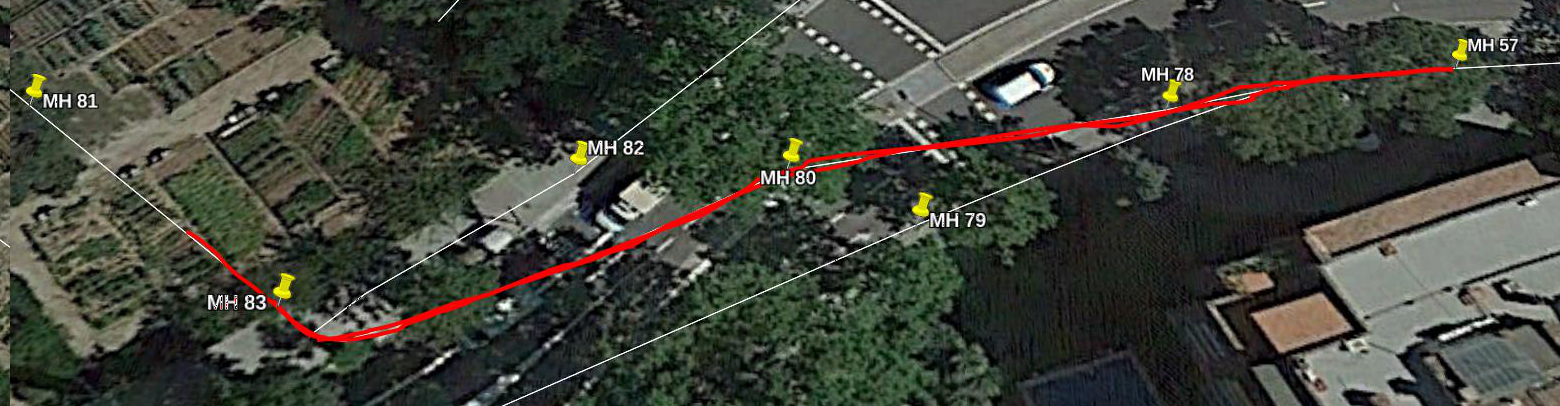
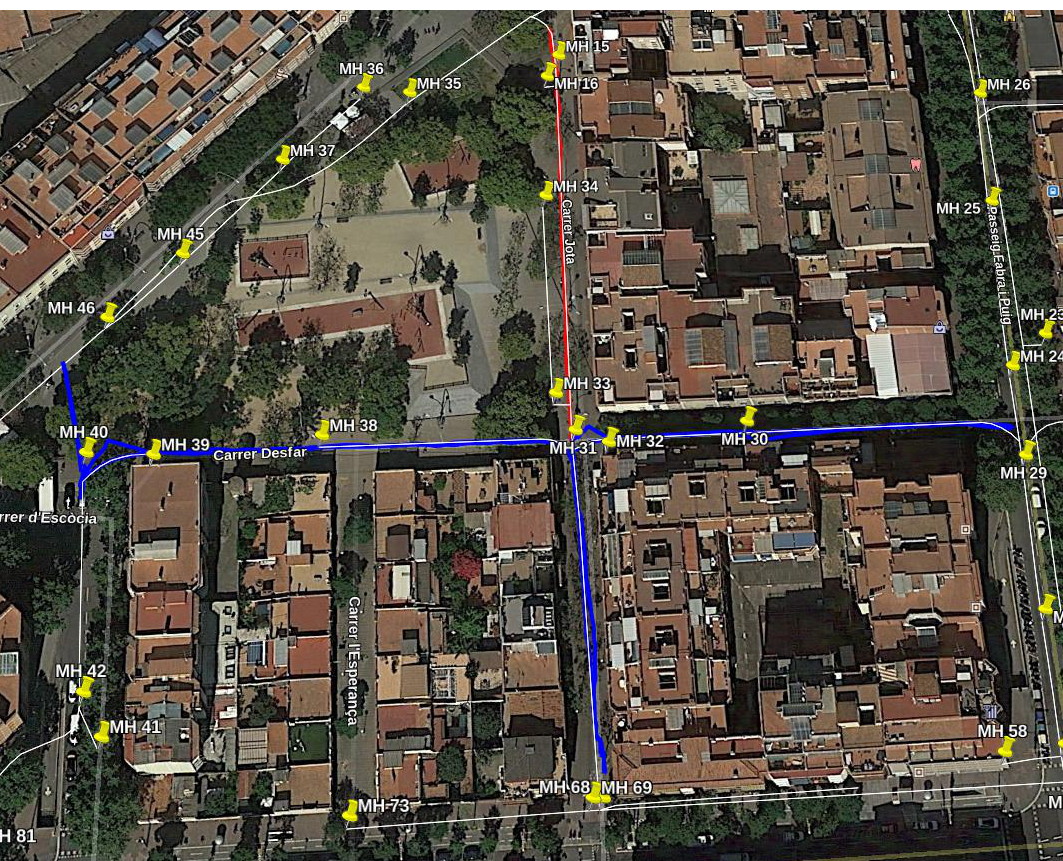
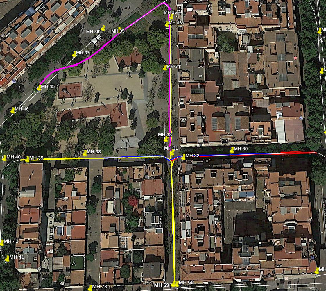
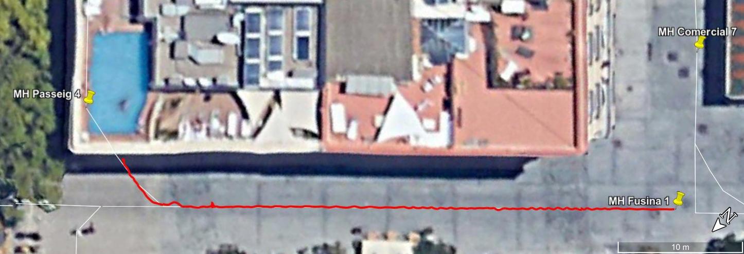
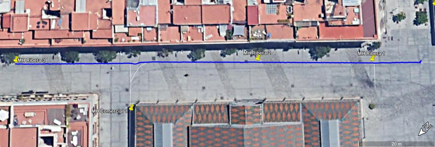
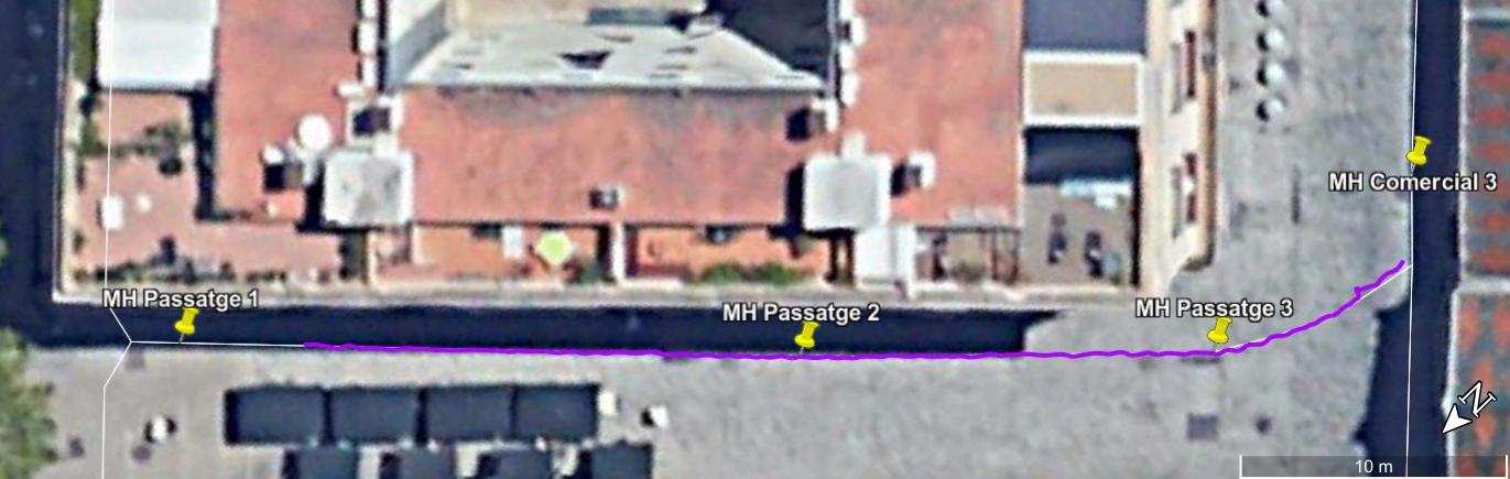
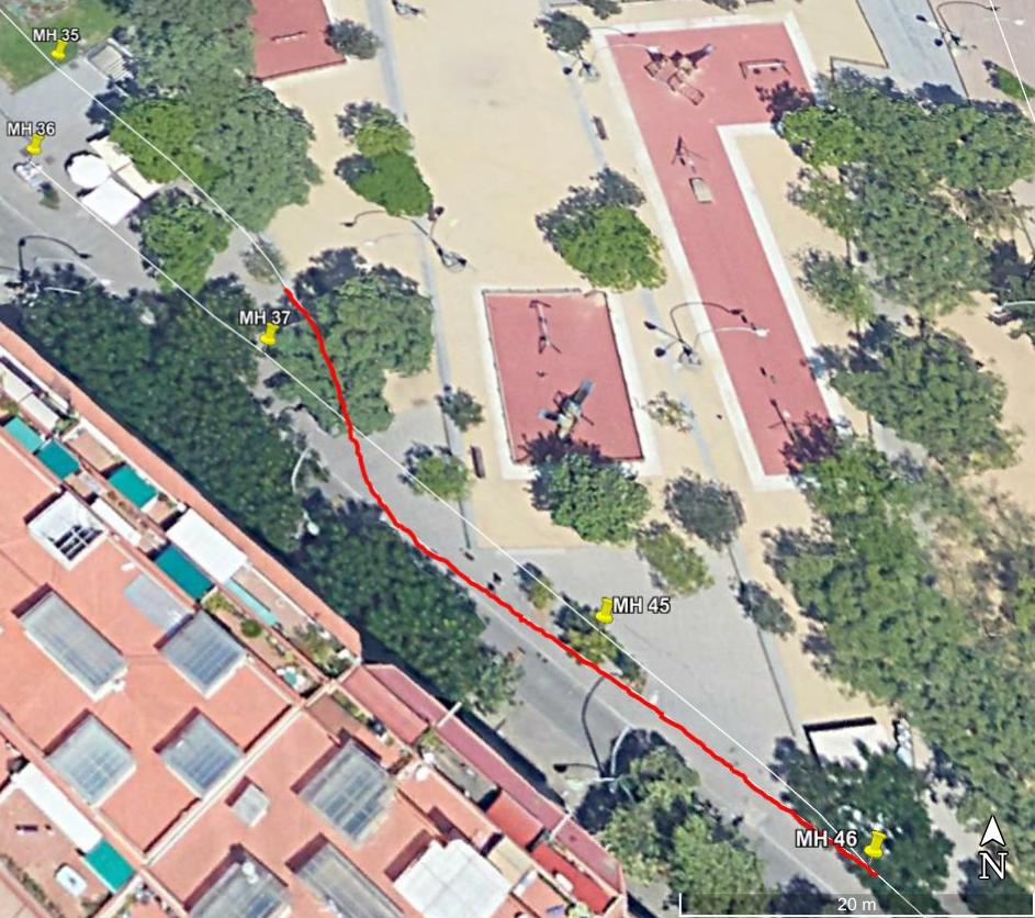
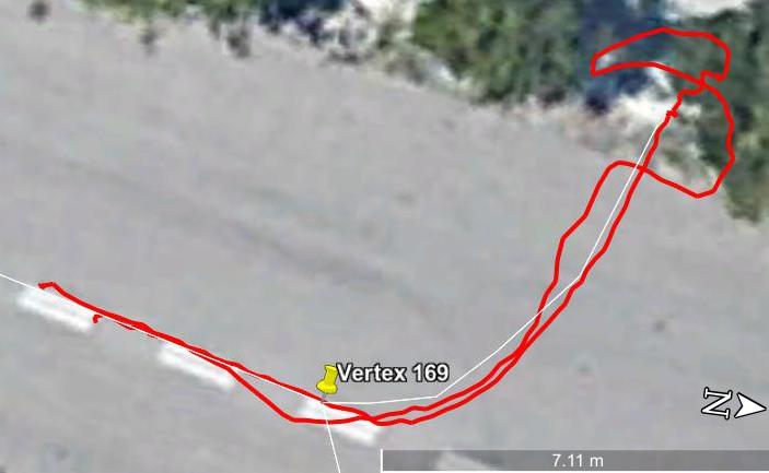
We present a, to the best of our knowledge, unprecedented set of data in a challenging indoor environment: the visitable sewers of Barcelona. The datasets were recorded in real sewers of different places of Barcelona with two different platorms: the SIAR ground robot and the ARSI aerial platform. They were designed to participate in the Urban Robotic Challenge for Sewer Inspection of the Echord++ project. These platforms captured RGB-D image sequences with their onboard cameras, laser scans (ARSI), IMU measurements, and many more. The set consists of logs obtained from more than ten different experiments in four different locations. In addition, we provide the users with a partial ground-truth and baselines of the localization of the platforms, which can be used for testing localization and SLAM algorithms. Details on the setup and execution of each mission and partial labeling of the elements found in the sewers.

The datasets are timestamped and stored by means of the well-known Robot Operating System (ROS) bag package. The contents of the different bags is detailed in the contents section. Unfortunately, the localization of the platform in such environment is a harsh challenge as it is a GPS-denied environment. We also provide localization results obtained with the tool that was presented in our paper "RGBD-based robot localization in sewer networks" at IROS 2017.

Copyright


All datasets and benchmarks on this page are copyright by us and published under the Creative Commons Attribution-NonCommercial-ShareAlike 3.0 License. This means that you must attribute the work in the manner specified by the authors, you may not use this work for commercial purposes and if you alter, transform, or build upon this work, you may distribute the resulting work only under the same license.


Citation


Please cite our paper on the dataset if you use the dataset for your research. It would be more than welcome!!

Plain text

Alejo, D, Chataigner, F, Serrano, D, Merino, L, Caballero, F. Into the dirt: Datasets of sewer networks with aerial and ground platforms. J Field Robotics. 2020; 1– 16. https://doi.org/10.1002/rob.21976

Bibtex

@article{https://doi.org/10.1002/rob.21976, author = {Alejo, David and Chataigner, François and Serrano, Daniel and Merino, Luis and Caballero, Fernando}, title = {Into the dirt: Datasets of sewer networks with aerial and ground platforms}, journal = {Journal of Field Robotics}, volume = {n/a}, number = {n/a}, pages = {1-26}, keywords = {aerial robotics, data set, sewer inspection, subterranean robotics, terrestrial robotics}, doi = {https://doi.org/10.1002/rob.21976}, url = {https://onlinelibrary.wiley.com/doi/abs/10.1002/rob.21976} }

SIAR System Overview

The SIAR robotic platform has been used for the presented datasets. It has been designed specifically by the portuguese company IdMind for the PTDI challenge for Urban Robotics of the project Echord++. It is an IP67 Rover-like 6-wheeled robot that is able to adapt the width automatically. The configuration of the platform in the presented dataset has the following components:

  • • Encoders in the robot base for odometry computation.

  • • IMU: ArduIMUv3.

  • • Six RGB-D cameras distributed simetrically in the front and rear part of the platform.

  • • An additional RGB-D camera pointing towards the ceiling for manhole detection.

  • • Gas sensor measures on some of the bag files in Virrei Amat Scenario.

  • • Weight: 58 Kg

  • • Battery autonomy: 4 hours

  • • Maximum Velocity: 0.75 m/s

  • • Acceleration: 1 m/s2

  • • Dimensions with minimum width (Height x Width x Length) : 44 x 50 x 98 cm

  • • Dimensions with maximum width (Height x Width x Length) : 44 x 70 x 84 cm

  • • Emergency Stop Acceleration: 3,3 m/s2

ARSI System Overview

The ARSI MAV is a compact quadrotor designed specifically for the operation in sewer sections as narrow as 70cm (at ground level). The size of the targeted sewer sections limits the maximum width of the frame, the maximum propeller size and thus the maximum take-off weight (MTOW). It is lightweight and robust, with an estimated flight autonomy of 13 minutes and a payload capacity of 1kg. The MAV carries several onboard sensors allowing it to execute autonomous inspections supervised by operators on the surface.The main features of the ARSI MAV are as follows:

  • • A quadrotor configuration with a carbon fiber frame.

  • • 11" propellers mounted at different heights to overlap and reduce the platform width.

  • • Dimensions (Height x Width x Length) : 31 x 62 x 81 cm.

  • • Flight autonomy: 10-15 minutes depending on the sewer section.

  • • Average velocity during sewer inspections : 0.5 m/s.

  • • Contact tolerant thanks to the propeller protection designed specifically for the dynamics of sewer inspection.

  • • Wide landing structure to cope with the central canal present in most sewers.

Data Description

Each one of the provided datasets are stored entirely in a large bag file. This file includes the sensors measurements, odometry. All the datasets are logged and also processed using ROS tools, such as the ROS Bag. Most of the information stored into the logs use ROS standard messages and follows its development main guidelines, so that the reader can understand easily the dataset with a minimum ROS background.

SIAR Data Description

In addition to the common data described above, the datasets recorded with the SIAR platform include some introspective information of the platform such as the raw odometry information and the status of the width-adjustment motor.

Therefore, in order to be able to process all the data inside the bag file, the user should compile our siar_packages repository, in which some custom messages are defined.

Each bag file stores the following data:


  • • Robot Odometry and SIAR Platform Status

  • • Compressed RGB and Depth Images

  • • Transform information of the disposition of the sensors.

  • • Baseline trajectories.

  • • Partial ground truth: precise information is stored whenever the platform passes below a manhole.

ARSI Data Description

The experiments in the aerial platform are much shorter than the experiments with the ground platform. Thus, there is no need for compressing the images.

Each bag file of the ARSI dataset stores the following data:


  • • Visual Odometry

  • • RGB and Depth Images

  • • Transform information of the disposition of the sensors.

  • • Baseline trajectories.

Scenarios

The scenarios considered in this work belong to the visitable sewer network of Barcelona. In this dataset we include experiments performed in four different areas: Mercat del Born, Virrei Amat Square, and two locations on the Pedralbes district. Next we detail the visited areas.

One partner of the project, BCASA, provided us with Geographic Data (GIS) of the areas to be inspected, which we present here in KML format and in a text file that describes the graph and can be loaded with our publicly avialable sewer graph ROS package .

This GIS information is used in both ARSI and SIAR systems for localization and mapping purposes.

Mercat del Born


The datasets obtained in 2017 were recorded in a pedestrian area of Barcelona: Mercat del Born. They were recorded in the process of fulfilling the main challenge of Phase II of the Urban Robotics Challenge of the Echord++ project: to inspect a 640m long track in less than 4 hours. In order to give a better idea of the environment where the experiments were carried out, the shape of the different sewer sections of this scenario is represented in the figure below. Please note that their labels appear at each sewer segment in the map on the right.


Creu de Pedralbes


In this case, this was a scenario that was proposed to the SIAR team as a preparation for the Phase III of the project. Therefore, only experiments with the SIAR ground platform are available. The track had a very variability in terms of the sections of the sewer galleries. The figure below represents the sections of this scenario.


Virrei Amat Square


This scenario had a length of roughly 500m and was divided into five sections as depicted in the map on the right. The starting four segments have a very similar narrow section of types T111 and T114A which was about 60 cm wide in the floor area. In contrast, the section of segment five varies from T158A to T141 and are noticeably wider when compared to the previous segments. The figure below represents the aforementioned sections.


Pearson Avenue


The last scenario held the structural automatic defect inspection demonstration of the Phase III of the project. The topological map of the scenario is shown in the figure on the right. This is the shortest scenario with an approximate length of less than 50m. However, it has one 90 degree turn before entering into a collapsed region that makes the scenario challenging to visit with both aerial and ground platforms.

The main section of the scenario is T111, which is detailed in a figure above (in scenario Virrei Amat). In this scenario, we present one flight of the ARSI platform.

Downloads

SIAR dataset

2017-09-21-12:17am
The robot traveled 1000+ m for 1:05:59s receiving 18000+ images in each RGBD camera.

Contents Download

2017-10-11-11:05am
The robot traveled 1000+ m for 1:02:55s receiving 21000+ images in each RGBD camera.

Contents Download

2017-10-17-10:12am
The robot traveled 1000+ m for 1:25:28s receiving 24000+ images in each RGBD camera.

Contents Download

2018-05-18-10:12am
The robot traveled 400+ m for 1:25:23 receiving 36000+ images in each RGBD camera.

Contents Download

2018-06-12-10:23am
The robot traveled more than 400 m for 31:02s receiving 11000+ images in each RGBD camera.

Contents Download

2018-06-12-10:54am
The robot traveled more than 400 m for 31:02s receiving 45000+ images in each RGBD camera.

Contents Download


2018-06-27-10:31am
The robot traveled more than 400 m for 1:15:03 receiving 32000+ images in each RGBD camera.


Contents Download


2018-06-28-09:57am
The robot traveled more than 400 m for 1:58:19s receiving 52000+ images in each RGBD camera.


Contents Download

2018-07-04-09:38am
The robot traveled more than 1000 m for 2:58:19s receiving 74000+ images in each RGBD camera.
The experiment was recorded in four different bag files that are stored in a zip file.

Contents Download


ARSI dataset

2017-10-16-15:05
The robot traveled more than 40 m for 03:36s receiving 6000+ images and 2100+ laser scans.

Contents Download

2017-10-16-13:41
The robot traveled more than 100 m for 06:00s receiving 10000+ images and 3500+ laser scans.

Contents Download

2017-10-16-16:03
The robot traveled more than 40 m for 02:35s receiving 4400+ and 1500+ laser scans.

Contents Download

2018-07-03-10:26am
The robot traveled more than 40 m for 04:20s receiving 3000+ RGBD images and 2400+ laser scans.

Contents Download

2018-12-11-13:05am
The robot traveled more than 40 m for 03:18s receiving 1100+ RGBD images and 1700+ laser scans.

Contents Download

Changelog


  • 2020-11-23: Added Copyright, Citation and Changelog
  • 2019-06-25: First version